No products
Orkney Guidebooks, Travel Books & Maps
- Latest Releases
- Signed Copy Event Pre-orders
- Orkney Guidebooks, Travel Books & Maps
- Calendars, Gifts & Souvenirs
- Orkney Christmas Cards
- Orkney Fiction, Poetry, Folklore & Myths
- George Mackay Brown
- Children's
- Local Author - non-Orkney Related Titles
- Orkney Life, People & Places
- Orkney History
- Maritime
- Photos, Art, Music, Food & Sport
- Nature
- Shetland Books & Maps
- Sale
- 'The Orcadian' Subscriptions
A range of Orkney Maps and guidebooks.
Orkney Guidebooks, Travel Books & Maps There are 72 products.
Subcategories
-
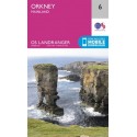
Orkney Maps
Maps; Orkney OS Maps (regular and 'active' laminated), pocket maps, Scotland maps.
-
Guide Books
Orkney guide books, visitor guides, walking books, nature guides.
-
Travel Books Feat. Orkney
-
Argonauts of The Scottish Isles
Sea-Kayaking Adventures. In this classic account of sea-kayaking adventures, Robin Lloyd-Jones recalls many a memorable expedition to wild and beautiful shores, from Scotland's magnificent west coast and Hebrides to the northern island groups of Orkney and Shetland. By Robin Lloyd-Jones. Paperback.
£ 9.99 -
The Orkney Pocket Book of the Orkney Vole
This is the third book in the handy 'The Orkney Pocket Book' series by Tim Dean. Learn all about the Orkney Vole 'the Cuttack - an unsung hero' in this paperback book.
£ 3.99 -
Shapinsay Reflective Routes
We at Shapinsay Kirk believe that our island is an ideal place for quiet contemplation and meditation - perfect for recharging your batteries. We wanted to offer you a selection of routes (walking, running, cycling, driving, swimming, singing, or paddling!) to facilitate such a quiet time and help you get to know our island better. A wellbeing initiative...
£ 6.00 -
The Art of Wild Swimming: Scotland
From the dramatic turquoise bays of Orkney to the peaty lochs of the Cairngorns, the thundering waterfalls of Skye to the calm depths of a reservoir in the Pentlands. Locals who know the secrets of their patch share over 100 spectacular dookin' spots across Scotland. Hardback.
£ 14.99 -
Islands of Abandonment
This is a book about abandoned places: ghost towns and exclusion zones, no man's lands and fortress islands - and what happens when humans leave and nature is allowed to reclaim its place. Featuring the Orkney island of Swona. By Cal Flyn. Paperback.
£ 9.99 -
Treasured Islands
The explorer's guide to over 200 of the most beautiful and intriguing islands around Britain. With sections on several of the Orkney Islands. Paperback. By Peter Naldrett.
£ 18.99 -
Orkney: A Special Way of Life
After moving permanently to the island he's always dreamed of, Richard Clubley here sets out to capture the experience of life on Orkney... Paperback.
£ 9.99 -
Scotland - OS Tour Map
Ordnance Survey Tour Map Scotland, including islands 1:500 000 scale 1cm to 5km - 1 inch to 8 miles
£ 6.99 -
Northern Scotland, Orkney & Shetland - 1 -...
Ordnance Survey Map. Northern Scotland, Orkney & Shetland, 1, OS Road Map. 1:250 000 scale, 1cm to 2.5km - 1 inch to 4 miles.
£ 7.99 -
The Orkney Pocket Book of Scottish...
Including when and where to see them. Handy pocket-sized paperback book. By Tim Dean.
£ 3.99 -
Orkney and Shetland: Cambridge County...
Cambridge Country Geographies reissued 1920s Guide. By J.G.F Moodie Heddle & T. Mainland.
£ 12.99 -
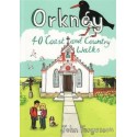
Orkney: 40 Coast and Country Walks
A pocket size guide with 40 coast and country walks all over Orkney. By John Fergusson.
£ 6.99


")

